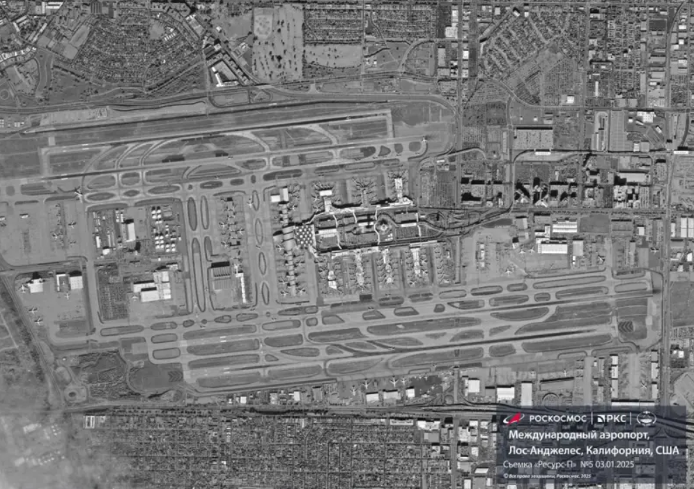
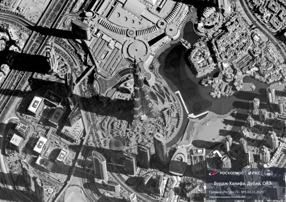
Russian satellite images captured using the advanced Geoton-L1 equipment have been released online, showcasing high-resolution monitoring capabilities of Earth’s surface. The Geoton-L1 system, a key component of Russia’s Resurs-P satellite, delivers optical-electronic imagery with an impressive spatial resolution of approximately 1 meter.

The published images, shared by Roscosmos, feature detailed views of various global locations, including regions in the United States, the United Arab Emirates, and China. Notably, high-definition images of Los Angeles are among the examples provided.
These specific countries were chosen due to the Resurs-P satellite’s flight path, which allowed it to capture these regions during its orbit. Equipped with the Geoton-L1 system, the satellite enables real-time tracking of specific areas, enhancing observation and monitoring capabilities.
Roscosmos presented satellite images of objects in foreign countries

Experts believe the online images may not reflect the maximum possible resolution. Given the 1-meter resolution capability, further detailing of selected objects, including infrastructure like Los Angeles International Airport, is feasible, demonstrating the precision and potential applications of the Geoton-L1 technology in satellite imaging.
«Роскосмос» показал первые снимки, сделанные спутником
Государственная корпорация «Роскосмос» опубликовала первые изображения, которые получил «Геотон-Л1» — основной прибор наблюдения поверхности Земли высокого пространственного разрешения спутника «Ресурс-П» № 5.

Напомним, 25 декабря ракета-носитель «Союз-2.1б» отправила спутник дистанционного зондирования Земли «Ресурс-П» № 5 на целевую орбиту.
Спутники «Ресурс-П» — это серия российских космических аппаратов дистанционного зондирования Земли (ДЗЗ), разработанных для получения высококачественных снимков земной поверхности.
Аппараты входят в программу российской космической промышленности по предоставлению информации для государственных и коммерческих нужд.
Israeli Airstrikes Strike Gaza: Over 50 Dead as Ceasefire Talks Continue


